Maps from Robin Boustead
We bought the digital maps in the GreatHimalayaTrail Web Shop. The digital maps serve both as an overview and we also use them in our physical and digital trail notes.
For our planning session we printed them as posters at http://myposter.de. Physical planning on the floor with post-its tremendously helped us to understand the details of the route, get a sense for the remoteness and where to expect villages/guest houses or plain campsites.
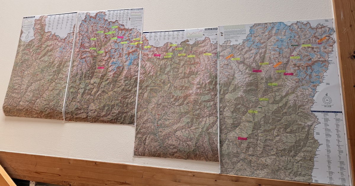
We hung the printed maps in our apartment. There they motivated us every day to train, push the expedition planning forward, and also spend some time each day to dream of Nepal.
GPS Tracks from Wildernessprime
Our main source for information about the route are the GPS Tracks from Wildernessprime. Dave keeps them updated with new information each year and has also added some waypoints with crucial information on landslides, bridges and and other POIs.
GPS Tracks from Himalayan Adventure Labs
GPS tracks are from 10 minute increments created by a satellite transponder used by Seth Wolpin during a 2014 crossing. In some cases there are more detailed tracks, and alternative routes. You can find a link to GPS Tracks on their page:
https://www.himalayanadventurelabs.com/great-himalaya-trail/interactive-map-great-himalayan-trail/
GPS Tracks Mike Dixon on Strava
Mike Dixon has shared his GPS tracks on Strava whare you can download. As Mike and Kristie completed the GHT in 2025 we used their GPS tracks to double check the route in remote and tricky areas as they should give a a good hint on the current best route.
Mike has published hist GPX tracks on Caltopo. In the below, hhe compared Dave’s track and Jeff’s tracks to theirs and and selected the most viable route. He also removed any errors or messy GPS problems and added more notes on top of Jeff’s notes.
- Full map with notes: https://caltopo.com/m/JPM4F16
- Broken into 125 Days: https://caltopo.com/m/FQMDTU0
- Broken into 10 sections: https://caltopo.com/m/ESH23L6
If you are interested in the raw tracks you can checkout his strava profile:
In particular:
Ghunsa to Olangchunggola
Olangchunggola to Hongon
- https://www.strava.com/activities/14432382911
- https://www.strava.com/activities/14432383418
- https://www.strava.com/activities/14432385801
- https://www.strava.com/activities/14432385612
- https://www.strava.com/activities/14432384815
Hongon to Yangla Kharka
- https://www.strava.com/activities/14609976953
- https://www.strava.com/activities/14609976878
- https://www.strava.com/activities/14609978061
- https://www.strava.com/activities/14609975677
- https://www.strava.com/activities/14609976823
Yangla Kharka - Sherpani Col, West Col, Amphu Lapcha - Chukrung
- https://www.strava.com/activities/14609975930
- https://www.strava.com/activities/14609974909
- https://www.strava.com/activities/14609974173
- https://www.strava.com/activities/14609974376
- https://www.strava.com/activities/14609973764
- https://www.strava.com/activities/14609973469
- https://www.strava.com/activities/14609973113
- https://www.strava.com/activities/14609972178
- https://www.strava.com/activities/14609973378